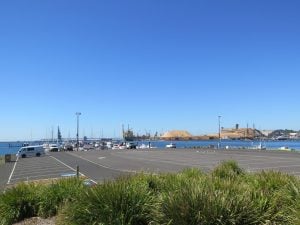
The marina in the charming town of Port Fairy
22nd March 2016
One can uncover history in every corner of this charming fishing village of Port Fairy at the end of the Great Ocean Road. The last destination on Victoria’s famed Shipwreck Coast, Port Fairy boasts wide streets lined with nineteenth century cottages, great Norfolk pines and old stone churches. You can see native animals in the wild, from southern right whales, seals and dolphins to wallabies, kangaroos and emus.
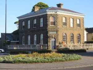 With many fine examples of 1800s architecture and more than 50 buildings classified by the National Trust, Port Fairy is the perfect holiday spot for history buffs. Follow one of the historic walking trails and discover charming, fully restored white-washed cottages built by whalers and seamen beside Georgian-style merchants’ homes and grand public buildings. Learn about the local maritime history on the Port Fairy Maritime and Shipwreck Heritage Walk.
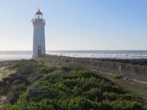 This morning we were up relatively early to greet a perfect sunny and cloudless morning. We decided to do the Griffiths Island walk to the Lighthouse, along the Moyne River and the areas where the shearwater nest. I love lighthouses, they are all so different. This particular one is only small, but it stands proudly at the entrance to the Moyne. There were some great views back toward the town, very picturesque nestled along the coastline. We noticed lots of different sea birds, and even a small wallaby was hopping through the area.
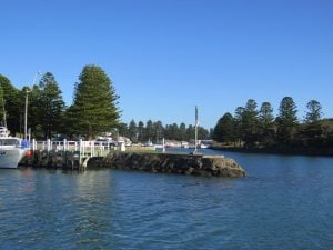
Once the walk was complete we drove through town and over the bridge to the narrow strip of land that runs between the beach and the canal formed in the Moyne River, which flows between the town. There were lots of boats along the canal, many of the homes have their own jetties to moor their boats, and it all looked very beautiful in the morning light.
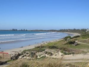
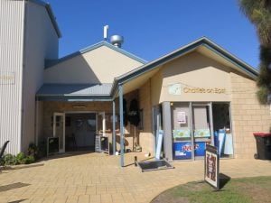
We drove along to the end of the road and walked to the Battery Point Beach which is quite pretty although rocky and lots of seaweed. Turning back toward East Beach (below right), we discovered Charlie’s On East Cafe and had a delightful breakfast overlooking the ocean (below left). After breakfast we made our way back to the village to take some photos of the wonderful heritage buildings in Port Fairy.
Reluctantly we left Port Fairy, both saying it was one of our favourite spots on this holiday. The next city was Portland, and we had a great view of the area on the hills leading to the commercial centre. Portland is located on the far south-west coast of Victoria, mid-way between Port Fairy and the small town of Nelson which is adjacent to the state border with South Australia.
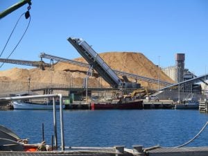
The massive harbour precinct of Portland with woodchips waiting to be exported
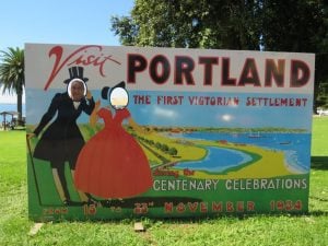
Portland was the site of Victoria’s first permanent settlement back in 1834, with the town quickly prospering due to fishing, pastoral and agricultural industries. Portland is the only deep-water sea port between Adelaide and Melbourne, making it a major centre for sea transport of goods and produce from the surrounding areas. A large sheltered harbour provides calm waters for a marina, wharves and shipping berths. One of Portland’s major industries is the Alcoa aluminium smelter which commenced operations in 1986. Portland is a place of historic discovery with over 200 buildings within the town classified by the National Trust, many of which are constructed out of bluestone.
The Information Centre was near the harbour where a lot of work is being carried out, so it was a little difficult to get in to the area. We learned from the friendly staff at the Centre that the huge piles of “stuff” that we could see on the southern end of the port were piles of wood chips, some of which is sent to China to be recycled into paper (then sold back to us!) and others are sent to Japan where it is converted into chipboard and furniture (and sold back to us!).
It was interesting to watch the activity on the harbour, especially the huge trucks that bring the woodchip to the port – the trucks back on to a platform that lifts and tips the truck backward so that their woodchip load is emptied into huge containers, and transferred to the ships (left). Alcoa Aluminium also have a factory in Portland and there is a huge pipeline at the harbour where the product is piped on to ships and sent to Western Australia.
We were lucky to have a glimpse of the cable tram (right) that wends it way throughout the city, but unfortunately we didn’t have time to have a ride.
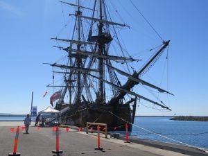
On the southern side of the harbour was also the Endeavour barque, looking splendid in the sunshine, there were lots of school children who were having fun on their excursion to the harbour foreshore.
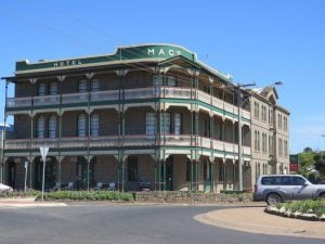
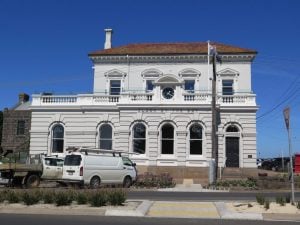
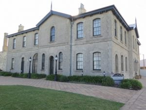
We walked along the main street and I was able to take photos of some of the well maintained historic buildings, and the wonderful views over the huge harbour.
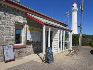
Our next stop was the Cape Nelson Lighthouse. The Cape Nelson State Park, is a 243-hectare (600-acre) state park. Attractions include a 3-kilometre (2 mi) clifftop walk and a visit to the Cape Nelson lighthouse. The lighthouse was completed in 1884 and today offers accommodation in the Light Station Keepers Cottages. Part of the course of the Great South West Walk is located within the park. Isabella’s Cafe is also located near the lighthouse and we took the opportunity of having lunch overlooking the coastal heath vegetation and the many small birds that live in the area.
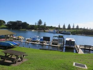 Time was moving along and we were yet to visit Nelson and Port MacDonnell. Nelson is a tiny town on the Glenelg River, we firstly drove to the Estuary Beach and then into the town itself. The river was very high, it had come partly across the road in some sections and where the boats were moored the water was lapping at the jetties. A few kilometres after we left Nelson we crossed the border from Victoria into South Australia, very disappointed there was no Welcome to South Australia sign, only a large sign reminding everyone of the quarantine regulations and to put any offending food etc into a large bin!
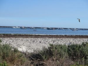 The last town was Port MacDonnell and we first viewed it from the hill leading down to the town. Port MacDonnell is the southernmost town in South Australia. The small port located on the Great Australian Bight in the Limestone Coast region about 477 kilometres (296 mi) southeast of Adelaide and 28 kilometres (17 mi) south of Mount Gambier. Once a busy shipping port, the town now relies heavily on its fishing and summer tourism industries, particularly the rock lobster harvest industry, proclaiming itself “Australia’s Southern Rock Lobster Capital”.
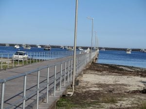 The first Europeans to see the area were led by explorer Lieutenant James Grant in HMS Lady Nelson on 3 December 1800. In 1860 the area was proclaimed an official port, was given a name, and was surveyed. It is named after Sir Richard Graves MacDonnell who was Governor of South Australia from 1855 to 1862.In the 1880s, it was one of Australia’s busiest ports, shipping large quantities of wheat and wool to Europe. The port was, however, exposed to the weather and the site of many shipwrecks. Across the border in Portland Victoria, 85 km southeast, is a much more sheltered port.
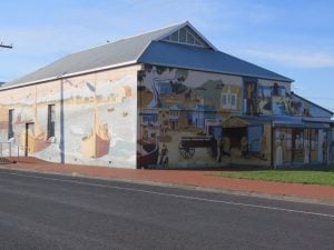
The town has a number of historic houses dating back to the mid 1800s, with a spectacular mural painted on what is now the local community centre.
The last leg of today’s journey was to the city of Mount Gambier. It was after 6pm when we arrived (although we had gained thirty minutes as South Australia is half an hour behind the eastern states), and we were very tired and had some trouble actually locating our motel.
Over the next couple of days we will explore the sights of Mount Gambier, and the interesting country around the city.



Aaron
Lovely area; lots of history, industry and spectacular beaches to. I like!